Tarrona is one of two major continents, second only to Celaphania and slightly larger than the Frozen Continent far to the south. Currently, there are sixteen recognized nations on Tarrona, counting the island of Kharam, but dozens of barbarian nations are located in the frozen north and speckled throughout the more remote areas. Tarrona is divided by the Carsovian Mountains which creates four distinct political regions: the Dark Kingdoms in the north, the Desert Kingdoms in the south, the Ultic lands in the west, and the Antarish lands in the east.
To learn about the kingdoms and nations of Tarrona, please read the article Kingdoms of Tarrona.
Cerunn Gulf
The Cerunn Gulf, once called the Cerúnn Sea (Ultic for “summer”), is a large inland sea on the western side of Tarrona. The sea is quite shallow, being only 50 fathoms (300 feet) deep on average, and 20 fathoms (120 feet) along the coastal regions, with depths reaching 200 fathoms (1200 feet) in some trenches. As a result, the sea is much warmer than other seas, and the water is surprisingly clear. The Cerunn Gulf features countless bays, coves, lagoons, and fishing villages speckle its rocky shores. The largest bays are the Beryl Bay and the Gambassu Bay.
Gulf of Antaria
The Gulf of Antaria is another inland sea, similar to the Cerunn Gulf in the west. The Gulf of Antaria once prospered with commerce and trade during the First Kingdom of Antaria, and again after the War of Tyranny, under the prosperous rule of the new kingdom of Antaria. Following the fall of Antaria, the Gulf became a hive of piracy and marauding Kaldean privateers. Today, Kaldea controls much of the Gulf of Antaria, although prior to the onset of the War of Wars, the Baronial navy had managed to secure much of its southern extent.
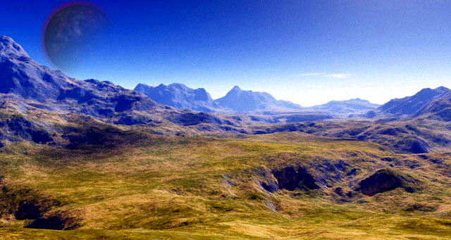
Carsovian Mountains
In the center of Tarrona, splitting north from south and east from west, are the prodigious Carsovian Mountains. Ranging nearly 1,000 miles from north to south and 800 miles at their widest, the Carsovians are second only to the Great Barrier Mountains in scale. To the north, in the high Carsovian Plateau, is the kingdom of Carsovia, and to the west is the war-torn country of Strigovia. Just north of the western peaks of Carsovia is the Scaithi-ruled land of Tir Scaith and the haunted battle fields of Moytura where, in ancient times, Eldren and Scaithi clashed in bloody war.
It is in this forbidding region that factions of vampiric blood-barons and rival sorcerers have for centuries warred with one another. But it is the common people living here who have paid the ultimate price for these long and bloody wars. The Senti people, native to the region, were long ago displaced, though many still remain and struggle to survive in the evil shadow of these splintered, jagged mountains.
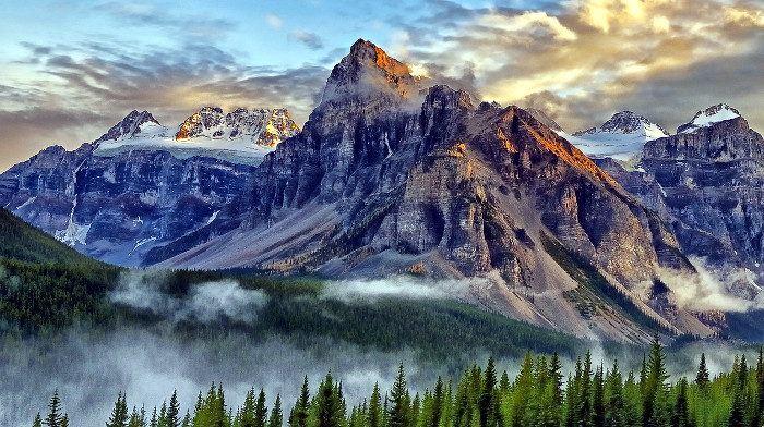
Boreal Mountains
Farther north than the Carsovians lie the frigid Boreal Mountains, also known as the Mountains of Fire and Ice. This mountain range marks the beginning of the arctic tundra of Tarrona, beyond which begins the desolate polar ice sheet. These mountains are volcanic, and while there have been no recent eruptions, some continue to smolder. The region is home to countless bands of nomads and war tribes, both human and Ogrum. Trolls also live in the mountains, but being solitary by nature are far less of a threat than the marauding war-bands.
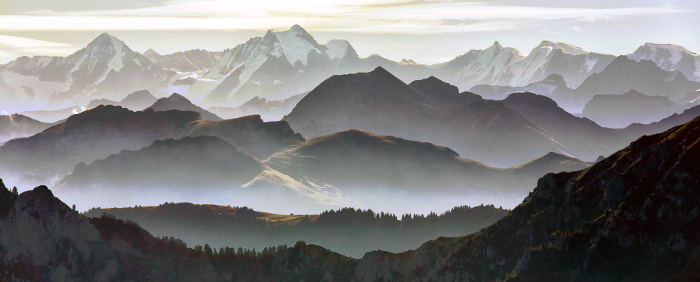
Falkshire Mountains
Markedly more pleasant than the foreboding Carsovian Mountains, the sylvan Falkshires are also smaller and more majestic. The tallest mountains of the Falkshires are snow-capped in the winter, but these caps melt in the summer to feed the rivers that flow through the Ethenwold and down into the Ruballi and Suddaean deserts, bringing much-needed water to those arid lands. The Falkshires themselves are of a mild and wet climate, dividing the dense Ethenwold to the east from the light woodlands and rolling plains of Bryland to the south and west. The Falkshires are home to many Eldren tribes, and some credit the strikingly pleasant climate to their magic.
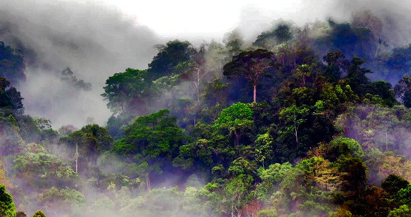
Ethenwold
The Ethenwold is a dense forest region east of the Falkshires in a lowland area that catches much of the runoff from both the Falkshire Mountains and the southern extent of the Carsovian Mountains. Only a few small rivers course their way beyond the Ethenwold to feed the scrubland plains between the Ethenwold and the Ruballi Desert, and fewer still trickle into the Ruballi itself.
The Ethenwold has always been a wild and savage land, even at the height of Antaria’s power. It is overrun with wild beasts and aberrant creatures, including barghests, dire wolves, bristlebacks, and tusked bears. The Ethenwold is also home to brigands and outlaws who have long plagued the merchant roads between Bryland and the Baronies of Ambricar.
The Red Valley
Located some one hundred miles west of Arbital in Ambricar’s Eastern Reach, the Red Valley is a geological active region rich in minerals and raw alchemical compounds. Throughout the region are countless hot water springs, fuming geysers, noxious sulfur shoals, bubbling alkaline lakes, and towering mineral deposits. Most of the springs are not suitable for bathers—the springs are quite toxic, and the water is so hot it could kill a man—but the springs are quite beautiful, coming in a variety of colors from deep blue to green to yellow and red. Bubbling-hot mud pits are also common throughout the Red Valley. Due to the high concentration of sulfur compounds, alkaline water, and other valuable minerals, the region has been extensively mined for its wealth of alchemical resources.
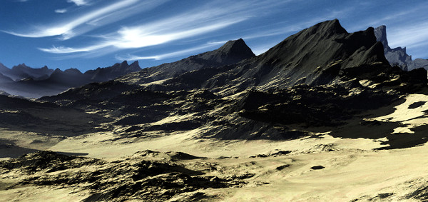
Ruballi Desert
The Ruballi Desert of eastern Tarrona is a vast expanse of hostile desert southwest of Ambricar and north of the Suddaean Desert. Also known as the Burning Waste, the Ruballi is actually the northernmost extent of the great Suddean Desert. Apart from a few isolated mining towns and frontier outposts, the Ruballi is uninhabited. The northern and eastern regions are primarily scrublands, while to the north and west the desert dissolves into rolling plains that meet the eastern edge of the Ethenwold.
Suddaean Desert
The Suddaean Desert fills most of the southern quarter of the continent of Tarrona and has remained relatively unchanged throughout recorded history. In spite of its inhospitable climate, there are rivers and oases to be found; it is around these rivers and oases that human settlements first formed in the region. The desert has been mined for diamonds and other precious stones for centuries, lending to the great wealth and riches of Suddaea.
Stone Valley of Kharam
Kharam is a mountainous island just east of Suddaea, across the then Sea of Kharam. Kharam is an independent kingdom with a rich and unique culture and is ruled by a king called a Kamair. Dividing Kharam itself is one of nature’s most awesome and unique wonders: the Stone Valley. The river Haptmur, which comes down from the northern mountains, carved out much of the valley, although wind and geological activity probably shared an equal part in its creation.
The most immediate feature of the Stone Valley is the Canyon of the Sun, through which the Haptmur river flows during the “wet” season (the rest of the year it is dry). As impressive as the canyon is, with its wind-carved towers of stone, rainbow-colored rock faces, and wide-open expanses, this is not the most remarkable place of interest in the valley. Corundum crystals are abundant here, and many of the rocks contain these and other valuable crystals, which contributes to the wealth of Kharam’s ruling families. Unsurprisingly, the people of Kharam have long held the Stone Valley to be sacred.
Taldacarn Caverns
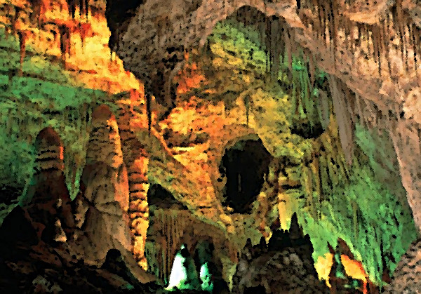
The Taldacarn Caverns are located in the wet lowlands south of the Parridon Mountains in the hinterlands west of the plains of Phana. Here, and throughout an area spanning some 400 square miles, are numerous sinkholes, caves, and deep caverns. Many of the sinkholes are hundreds of feet across and hundreds of feet deep and are so old that they are now filled with trees and vegetation. Some, however, are much newer, and others are known to have formed only a few hundred years ago. It is believed that the sinkholes formed as a result of ancient underground rivers that chewed out the limestone bedrock of the region.
The 400-mile area of sinkholes is remarkable enough to make this place a natural wonder, but it is also one of the largest known underground cavern systems in the world (Elderdeep is the largest, but the truth is, no one has explored either cave system in its entirety). At least 100 people have vanished over the past 50 years while exploring the caves, and reports of ghosts and specters are unusually high in nearby villages. Floating spots and strange colors have been observed in and around the sinkholes before or after a minor quake, spawning many superstitions, stories, and legends in the region.